My California - Bear Creek
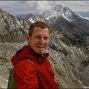

For this weeks Show Us Your California contest by @thesocalhive I headed up into the San Gabriel mountains for an overnight trip to...
Bear Creek!

My buddies Ryan and Larry and I headed up into the San Gabriel mountains for a fun overnight backpacking/fishing trip at Bear creek. We drove up the San Gabriel river on highway 39 to the West Fork trailhead where the West Fork splits from the North Fork. We parked, tossed on our packs and then headed out. The hike started by crossing a bridge across the West Fork to the road on the far side. The road provides access to the Cogswell dam up higher on the West Fork, but besides dam personnel and forest rangers and things like that it is closed to vehicular traffic. We hiked up the road along the river for a mile passing the occasional hiker or cyclist to the fork with Bear creek where our trail began.

The West Fork from the bridge crossing

Hiking up West Fork road

The junction of the West Fork and Bear creek
We started making our way up Bear creek and it wasn't long before we had to start making creek crossings. The water was moving pretty swift, but we were always able to find decent crossings where it never really got more than knee deep. In some spots the trail was easy to follow but in other spots it was difficult to find and even non existent so we'd just follow up the creek. There was also lots of poison oak which me and Ryan did our best to avoid while Larry walked right through it claiming he was immune. He even stopped and rubbed some on his face to prove his point which I guess must be true because he never had any reaction from it! Besides the poison oak the hike was very pleasant. Absolutely beautiful scenery and perfect weather, warm but not too hot. After a couple miles we arrived at the first camping area. We thought about staying there because it's probably the nicest camping area in the canyon. It's on a big flat bench just above the river and is shaded by huge live oaks. But it was still early in the day so we decided to press on and go a bit further.

Hiking up Bear creek

One of many crossings

Hiking up Bear creek
We continued up the canyon crossing the creek several more times eventually arriving at the old stone cabin ruins and we decided to setup our camp there. After setting up camp we just relaxed for a bit and then eventually we decided to grab our fishing poles and head out to the creek to see if we could catch anything. We started out downstream a bit from our camp and then slowly worked our way up casting as we went. I only caught one tiny little 3 inch trout, but Ryan caught a better one that was more like 6 or 7 inches. At one point there was a nice looking pool and I decided to jump in and cool off which felt amazing. We went a little ways upstream above camp, but not too far before giving up and heading back. Once back at camp we just chilled out and had some drinks and some food and at some point after dark we all headed off to bed.

Arriving at the cabin ruins

Setting up camp

Hanging my hammock

Looking upstream from near camp

Views of Pine mountain from our camp

Looking for trout

I got my 3 incher right by that bedrock on the left

Views of Twin peaks and Triplet Rocks

The pool where Ryan caught his fish

Relaxing at camp
In the morning I realized that I picked a bad location if I wanted to sleep in because as soon as the sun was up it was hitting me directly in the face. Luckily it was actually good thing to get up and get going early to avoid the hottest part of the day. We made some breakfast and then started getting camp all packed up. Once we were all packed up we headed out and started making our way back down the canyon. It was much hotter than the day before, but luckily the many creek crossings gave us plenty of opportunities to cool off a bit. Once back to the West fork it was just one more mile down the road. But it was definitely the hottest part and for me that last mile was the toughest of the whole trip. All in all it was a great trip, with two awesome friends, in an absolutely beautiful part of the San Gabriel mountains!

My hammock getting baked in the morning sun

Larry crossing the creek

San Gabriel scenery

Wildflowers on the trail

Hiking out
And so until next time...
I hope you have enjoyed this glimpse into
My California!!



#SoCalHive is building and supporting the Hive Blockchain community in Southern California. If you are from SoCal and are into creating quality content here on Hive, we'd love for you to follow us @theSoCalHive and join our group on Discord




World Mappin
You can check out this post and your own profile on the map. Be part of the Worldmappin Community and join our Discord Channel to get in touch with other travelers, ask questions or just be updated on our latest features.
Hiya, @ybanezkim26 here, just swinging by to let you know that this post made it into our Top 3 in Travel Digest #2940.
Your post has been manually curated by the @worldmappin team. If you like what we're doing, please drop by to check out all the rest of today's great posts and consider supporting other authors like yourself and us so we can keep the project going!
Become part of our travel community:
Great post D!
Congratulations @derekrichardson! You received a personal badge!
You can view your badges on your board and compare yourself to others in the Ranking